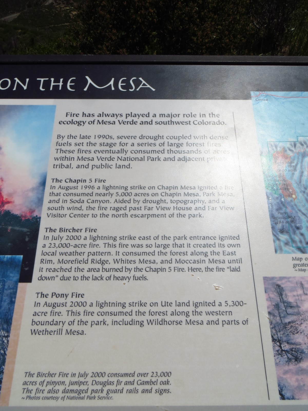
We left off at the Black Canyon of the Gunnison National Park (B on the map). After arriving at sunset the night before, Bill and I found a camp spot and set up in the dark. It wasn't too bad since we had head lamps. Bill also made us some awesome grilled cheese sandwiches. Any food involving melted cheese puts me in a good mood :)

A. Mesa Verde National Park (days 1 and 2) B. Black Canyon of the Gunnison National Park
C. Cottonwood Pass D. Independence Pass E. Aspen
Today's route starts at the Black Canyon of the Gunnison (B) and ends in Aspen. This was one of a couple epic days of travel we had in a row.

Our camp site after we broke everything down. It was a nice spot, but we didn't have time to stay there long.

A deer hanging around the camp ground.

An explanation of the geology of the Black Canyon of the Gunnison. Pretty interesting.

This picture of the edge of the canyon demonstrates exactly what the sign was talking about. You can see this all over the canyon. It's pretty neat.

More about the geology of the canyon if you're interested.

This is what Sunset Point looks like during the day. Here's last night's photo for comparison:


Another view of Sunset Point

A close up of the Gunnison River during the day. Last night's shot:


The canyon was not particularly wide in the spot we visited. I didn't need to zoom in to get this shot of the canyon wall. It's also difficult to tell how large this canyon really is through photos.

I had to use a 20x optical zoom to get this shot of the river directly below us. The next couple of shots will give you an idea of exactly how far away this is.

Zoomed out to around 10x.

About 3x.

Normal viewing of the river from our perspective.

I'm pretty sure Bill took this picture right after I was done taking those ones lol. The high altitude sun was killing me that day. It was pretty hot at the Black Canyon of the Gunnision.

Wearing my Virulent shirt with a floppy hat and a sunburn. Hardcore!


I thought this name was fitting.


Me taking that picture.

This cactus flower. Just WOW. I've never seen a cactus bloom quite that color in Arizona. It was on a small hedgehog-like cactus. I had to contort myself in to a position perched on top of a rock in order to get this shot without casting a shadow over the flower.

These juniper branches were very cool.

The photographer at work.

This wall with the stripes all over it is called the Painted Wall. It is the highest cliff in Colorado at 2,250 feet. To give you some perspective, the Empire State Building is
1,250 feet tall.

More shots of the painted wall.

I really like the patterns.


Bill and I in front of the wall.

Bill looking over the canyon.


Bill and I both took shots of this tree from different angles. The one below is Bill's shot.


We were both very intrigued by this "ribbed" mountain in the distance.

I liked the color in these flowers.


Bill taking another shot of the painted wall.

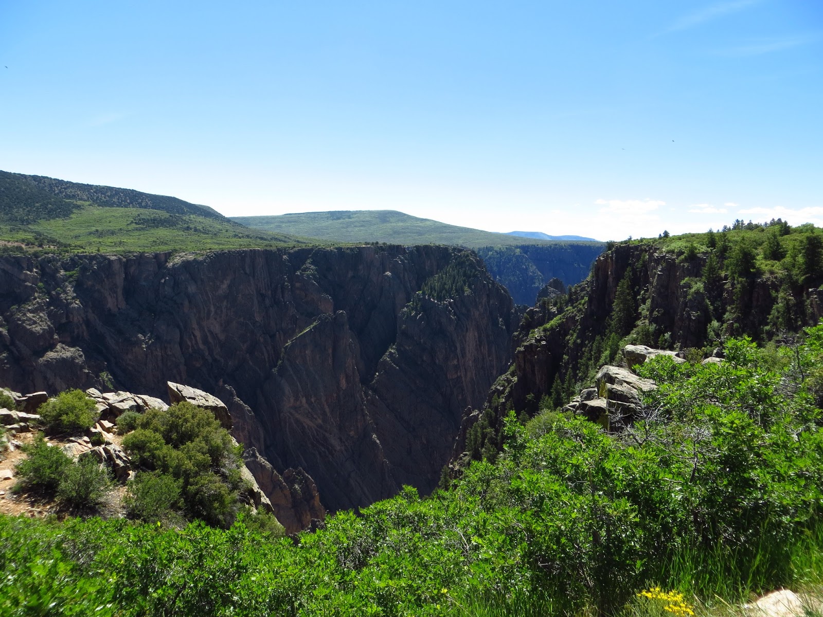
The canyon from a different viewpoint.

I love all of the jagged edges.


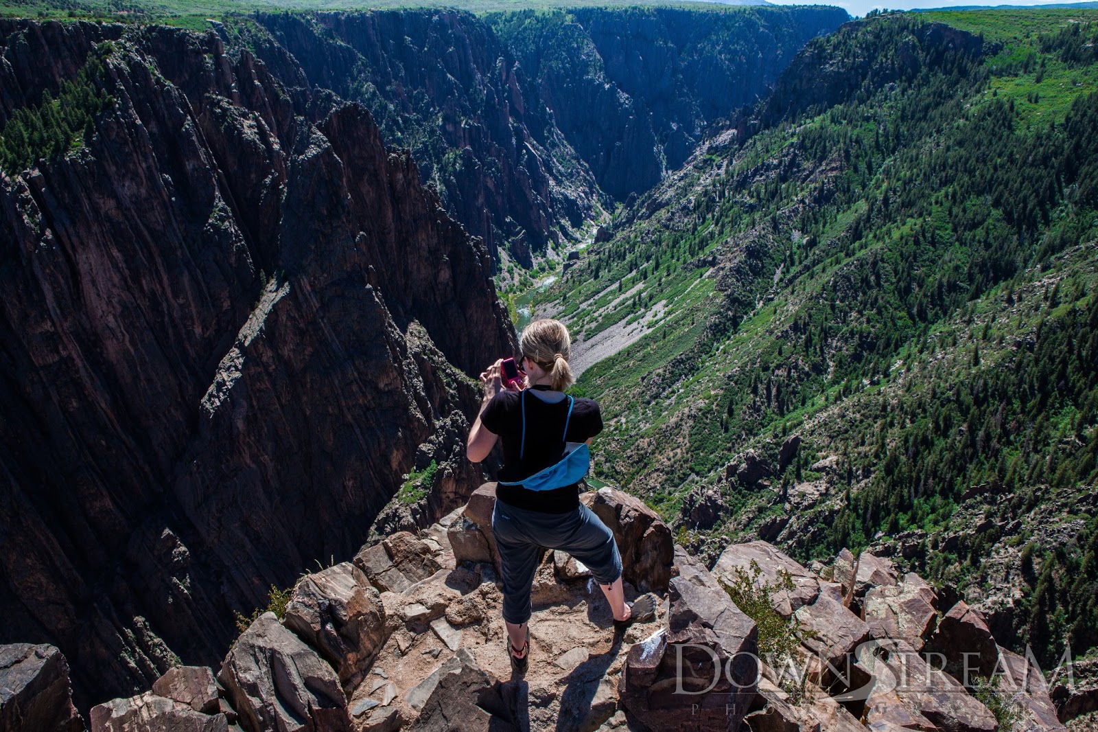
Bill held his camera way above my head on his tripod to get this shot. I think I was taking the picture above this one.


The hillside across the way was so green.


I liked these trees growing on top of a bunch of jagged rocks.

Bill standing near the edge.
After admiring the Black Canyon of the Gunnison, we headed out on the road toward Aspen. On the way, we planned to take a couple of scenic mountain pass roads. The first one we planned to take was the Cottonwood Pass (C on the map).
A. Mesa Verde National Park (days 1 and 2) B. Black Canyon of the Gunnison National Park
C. Cottonwood Pass D. Independence Pass E. Aspen

On our way to the Cottonwood Pass, we drove by the large lake that had resulted from the damming of the Gunnison River. Like the Grand Canyon, the Black Canyon of the Gunnison was formed by a large unruly river that has now been dammed and isn't doing nearly as much to carve the canyon anymore. The lake is called Blue Mesa Lake and really isn't much to look at aside from its size (you can see on the satellite map that all of the trees and greenery pretty much disappear as soon as you leave the Black Canyon of the Gunnsion) , so I didn't take any pictures.
Soon after leaving the area of the canyon and the large lake, we stopped at a small fishing shop in the small town of Almont looking for a map and a bathroom. It was one of those funny small town experiences where the people who own the business don't really seem at all interested in selling you anything and just seem totally annoyed that an outsider is there. Bill and I wanted to buy a map at the store and had to do quite a bit of work to get the owner to help us find what we were looking for. I was pretty happy to head down the road.
After a beautiful winding drive along the Taylor River, we came upon the Taylor Reservoir. Bill and I had to stop and take pictures.


The white patches in the grass are flowers (pictured below)


Bill took this shot of me taking that flower picture. He's very sneaky...

Bill looks very in his element here.
After reaching the reservoir, we turned on to the Cottonwood Pass Road, which is a winding dirt road. I found this anti-nausea ginger gum the day before at Walgreens and it was my saving grace the entire trip. Between the altitude and and the long, bumpy, winding drives, I would have been a mess without it:

The view from the top of the pass was beautiful:

Taylor Reservoir from the top of the pass.

It seems fake.


Yep, there was still snow on the ground.


Bill being sneaky again.


The Taylor Reservoir.

You can tell I'm not used to the altitude in this picture haha.

People sledding. In June.

We stopped at the official Continental Divide to take a picture of the sign. This was the pile of snow next to our parking spot.

There's a storm a-brewing!


An ice melt pond.


The weather changes very quickly around the Rockies.

The way down the other side of the pass was paved and a lot faster going. We took a pretty drive down the mountain before stopping for lunch.


We decided to take some shots at this stream.


We stopped at K's Dairy Delite in Buena Vista for lunch. It was a cute little burger and shake place where your order name was the name of a famous celebrity. They would call your "name" over the speakers. It was pretty funny. They also had interesting quotes taped all over the wall. My favorite part was the milk shake. Mine was oreo :)

Next, we took the trek back up into the mountains toward Independence Pass.

A pretty lake along the way.


The road to Independence Pass was paved the entire way and was much busier than Cottonwood Pass, probably because of its proximity to Aspen. When we reached the pass, it was very cold and very windy.

Apparently the vegetation in the tundra is extremely fragile and takes many years to grow.


The viewpoint at the end of the trail. It wasn't far at all, but it took me forever to get there with the low oxygen.


This is the point where I was really wishing that I had worn full length pants haha. You can see the wind whipping at our clothes.

I gave up on the hat. It kept blowing in my face. I had to attach it to Bill's camera bag to keep it from blowing away.

We were trying to figure out what was going on there.

Some of the beautiful tundra flowers.


Second time over the Continental Divide in one day!
Then we got to Aspen and I couldn't believe this place existed. It must be like the first time someone from outside Arizona visits Sedona. The town itself was very nice, but the scenery, just Wow. Bill had reserved a campground last minute in the Maroon Bells Wilderness. We had no idea what it was like and I was just happy that we already had a place picked out. Then, we drove up to the campground and it looked like this.

I kept calling it a magical fairy land. I couldn't believe it was real! And this is what the area right next to our campground looked like. There were only about 5 other camp spots and they were all spaced apart so you could enjoy the scenery.

Our camp site. Really.

Next to our tent.


Bill setting up the tent while I frolicked around taking pictures like an excited little kid.


We decided to drive right down the road and take a look at the Maroon Bells in preparation for taking pictures the next day.

Aspens everywhere!

A quick glimpse of the Maroon Bells right after sunset. This picture doesn't even begin to hint at how beautiful they are during the day. You'll see those pictures on Day 4.

A deer.


Driving back to our campsite. Feels very impressionist.

Our tent surrounded by Aspens.

I decided to play around with some long-exposure pictures.


I'm a ghost!! I was playing with Bill's idea from our trip a couple of years ago
Check back for Day 4: The Maroon Bells, the highest paved road in North America, and Casa Bonita.