On a Saturday about a month ago, our regular hiking group set out on a hike from First Water Trailhead near the main scenic view area of the Superstition Mountains to Canyon Lake. As usual, we started out a bit late. First, we dropped by the grocery store for Nature Valley bars. Then, we decided to buy Jimmy Johns Sandwiches to put in the cooler for later (because you can't go hiking without a reward afterward!). Finally, we had to drive two cars out to Canyon Lake, leave one there, and then drive the other car out to the First Water Trailhead. When it was all said and done, we didn't get to the First Water Trailhead until about 12:30.
While we were assembling our gear for the hike (we're training to backpack, so we brought all sorts of food, gear, jackets, etc. to weigh down our packs), we talked to a couple in the parking lot who were heading out on a different hike. As usual, we had the obligatory conversation about the fact that the Superstition Mountains are far more dangerous than people usually realize, and how we've all met those tourists who try to hike there with maybe one bottle of water, no knowledge of the area, and inappropriate shoes and clothing. The man we were talking to brought up the fact that he had once tried going hiking out there in a cheap pair of athletic shoes. Apparently the hike was rather long, because the shoes broke at some point and he ended up walking about 14 miles barefoot back to his car. I'm not sure if this was true, but it was a good story.
Before we left for the hike, we had spent time researching maps and descriptions of the trail online and were fairly confident of where we had to go and what the terrain would be like. The trail was going to be 7.3 miles, about two and a half miles farther than we had gone in previous hikes. Bill had his GPS with him, and James, Gabby and I had hiked a part of this trail about a month before.

This tarantula saw us coming and ran to hide. I managed to snap a photo of him before he went in his hole.
We
were making great progress down the trail. So far we hadn't been to
anything new that James, Gabby, and I hadn't seen. I was mostly down
hill and well worn from horses. It was a little warm out (the trail was
fairly exposed), but it was pretty. We stopped a couple of times for
snacks and we were in good spirits.

As we continued down the trail we began to forge new territory that James and Gabby and I hadn't been to previously. Gradually, the desert gave way to this beautiful green area next to a stream.
While we were enjoying this beauty, Bill checked his GPS and brought up the fact that we were only about a mile away from the car. That didn't make any sense. We had been hiking for at least three miles. The only way that we could be a mile away from the car is if we were travelling back that direction in a loop. We were perplexed because we had been pretty sure this was the correct trail. There were some people camping by the stream, so we decided to ask them if this trail went in the right direction. I was not happy to hear their answer. Apparently the trail we wanted to take had split off from our current trail about a mile and half back the other way.
So, we turned around and hiked back the way we came, uphill, for a mile and a half. At this point, it was getting to be about 2 o' clock and I began to worry that we weren't going to make it to the lake before dark.

The view from this part of the trail. At least it was pretty!

When we reached the area where the trail forked, it was still not immediately obvious which way to go. There was a posted sign at the fork, but it was unclear. Other people had decided to mark the side trail that we had accidentally taken as the correct trail, even though this trail wasn't even listed on the Superstitions map at the trailhead. Once we figured this out, we headed down the correct trail.

The right trail!

Gabby and I took the lead for a while. This area was even prettier than the other area and had cool rocks and boulders everywhere.

After we traveled along the wash for a while, it converged with a small creek and all of a sudden we were in a green area again.

Devin and James

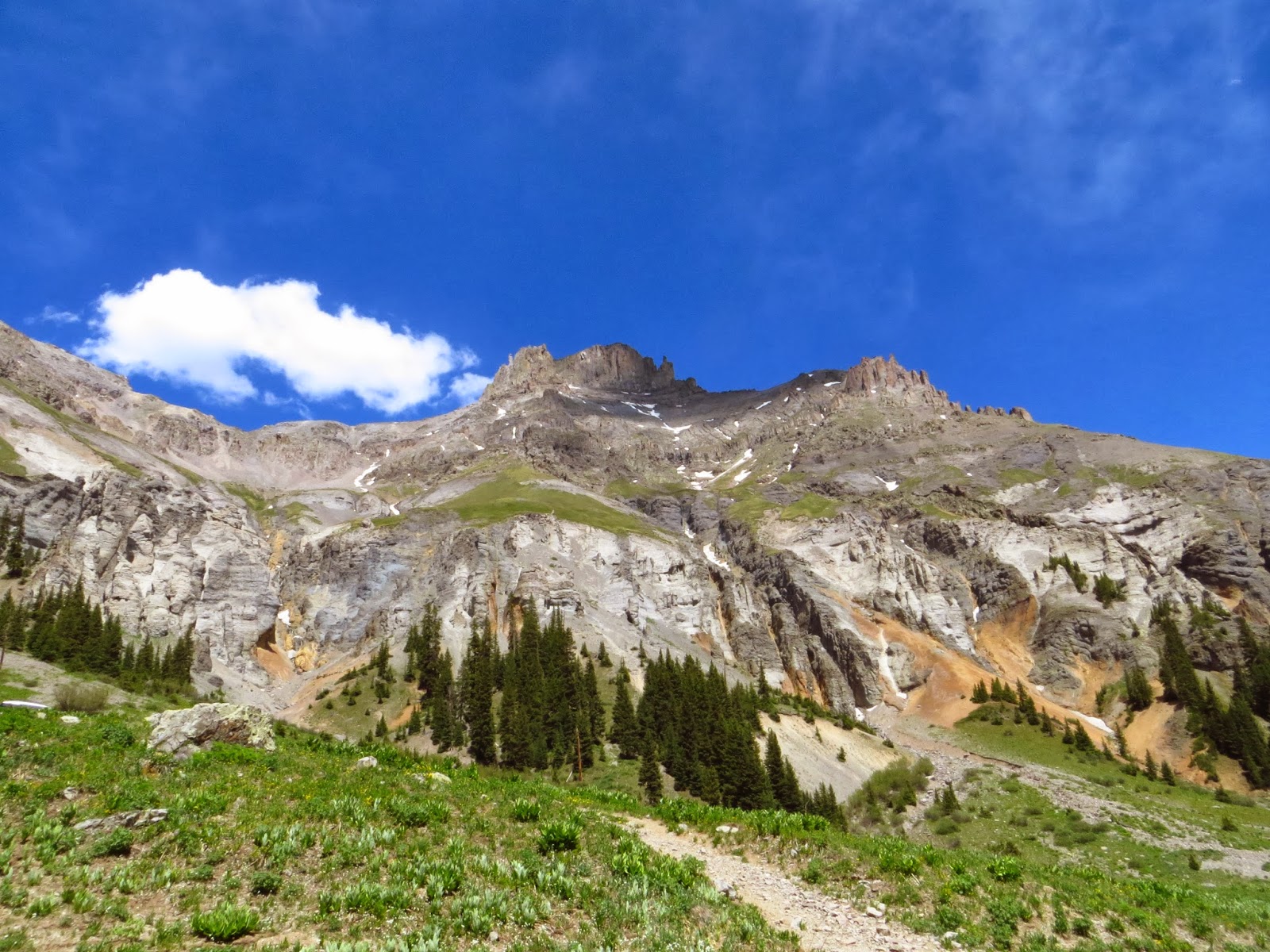
The Superstitions always have really cool rock formations.

As we continued along the trail, we ran into a large wash that still had some rain puddles in it.

Looking the other direction at the wash.

Bill giving me a sly look.

After hiking for a while, we came upon these cool ruins (below). Later on, I found some websites that refer to these as the "paint mines." They said that Native Americans used to find minerals for paint here? I'm not sure if that's true or accurate, but it was pretty clear that some type of miners (maybe gold?) had been in here in the recent past.


The fireplace.

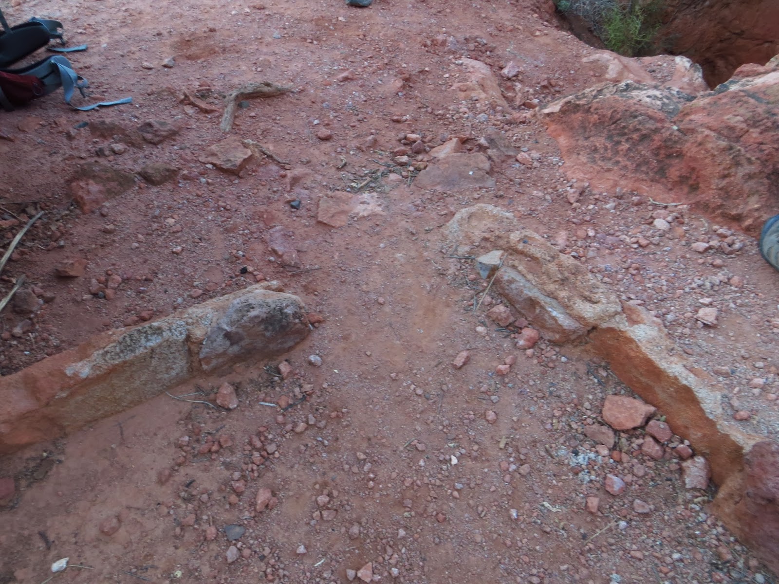
A doorway.
We stopped at the ruins for a little while to have a snack, stretch, and put on some warmer clothes. Then, we began the final trek down the trail.

This canyon was very cool. It's called Boulder Canyon. Apparently, it stretches on for miles and miles. The large rock formations that made up the walls of the canyon were really worth seeing. I want to go back there and camp.

At this point, we were still on the canyon floor. The hiking was nice and flat and the views were beautiful.
A few minutes later, we encountered the part of the hike we'd been dreading the entire time: the ascent. When we were researching this hike, we had read repeatedly that the last part of the hike had a very abrupt ascent of about 500 feet. Just when you're about ready to be done and completely exhausted, the trail hits at full force.
All of the descriptions we had read were not lying. The ascent out of the canyon was absolutely brutal. Endless uphill with endless switchbacks and almost nowhere to rest. The sunset in the canyon, however, was beautiful. We reached the top of the ascent during the last sliver of light.

The view down the canyon from the top of the ascent.

Bill watching the sunset.

James and Gabby catching their breath.

Bill and I.

Devin showing off the new knife he had gotten to add to his collection of outdoor gear.
As darkness fell over the canyon, we began to hear crickets and other desert insects come alive. We yelled down the canyon to hear our voices echo and admired the view. But, we weren't quite done yet. At this point, we were exhausted, but our GPS showed that we were only a couple of miles away from the car. We knew that we'd be hiking with headlamps, but we figured that we'd be back to the car and our Jimmy Johns sandwiches soon enough.
What we hadn't anticipated was the fact that we hadn't hiked more than five miles on our previous hikes and the 7.3 mile trail to Canyon Lake was supposed to be a stretch for us. With the added three miles that we accidentally hiked earlier on the trail (1.5 miles to the stream, 1.5 miles back to the fork), we had already hiked about nine miles by this point. So, instead of an easy 2.5 miles that were mostly downhill in the sunset, we hiked a very difficult 2.5 miles in the dark by headlamp.
All of us were in terrible pain. Our feet hurt, our legs hurt, our knees hurt, and our ankles hurt. It did not help that we were traveling consistently downhill on rock. We limped along at a glacial pace, made only worse by the fact that we were hiking by headlamp and needed to pay careful attention to where we stepped.
Halfway through our descent we stopped to take a rest. We could see the lights from the marina in front of us, but we weren't quite there yet. Sitting felt great, but it was a tease. It just made my feet swell and it hurt that much more to get started again.
After painfully plodding down the hill for three hours (we didn't reach the car until 9 p.m.), we finally stepped on asphalt and ended our accidental 11 mile hike. It was the best moment ever. We walked to the car and ate the best tasting Jimmy Johns sandwiches we'd ever had.

Devin so happy to see the car that he is "petting the man made surfaces."