Anyway, this is what I had for lunch after we gave up on the last tour. I smuggled SO many saltines in my purse...

On our way out, we drove to the highest point in the park to see the view.

You'll be laughing at this "high" elevation later.


This is another area that had experienced a past forest fire. Ignore the weird tags on this image. My Thinglink plugin is having some kind of weird malfunction that I have no control over :/
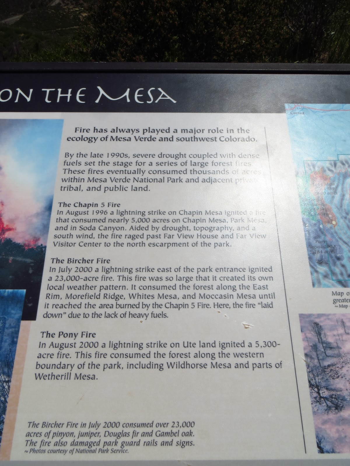
One of the informational signs.


This was a cool view. All I could think at this lookout point was how badly I wanted to be in those distant mountains and see some pine trees.

The panoramic view from the top.
After visiting the highest point at Mesa Verde National Park, Bill and I started on the next leg of our trip. We decided to head through Durango and take the Million Dollar Highway on our way to Black Canyon of the Gunnison National Park.


Somewhere past Durango. It all looks fake after this. It reminded Bill and I a lot of Alaska.


Aspens!


The bug beard so far.


We stopped at Molas Pass to take some pictures. We were at our highest elevation so far at 10,910 ft. I had to walk up a small hill to take these pictures. My heart was racing!


These were everywhere in Colorado.

There are a couple of tiny mountain paradises you pass though on the Million Dollar Highway. One of them is Silverton. It's perfectly nestled a the base of these mountains and it's a pretty town.

I snapped some shots from the car as we drove through.


Many of the small towns on the route were started by miners and you see a lot of historical mining structures along the drive.


The volcanic rock poking out of the tree tops reminds me a lot of the rock colors in Yellowstone.

I love the tunnels through the rock.

Ouray is amazing. This is the other mountain paradise you drive through on the route. Just beautiful. Bill and I were obsessed and wanted to come back.

This building says it all.


This canyon is really quite shocking when you first see it. It comes up with absolutely no warning and the walls are craggly, dark, and jagged. They look like something that belongs in Mordor. I was very into it! It's also very deep. The drop is around 2,000 feet at this point.


Bill and I got some late sunset shots at sunset point. The Canyon was carved by the Gunnison River. It's lit up by the sunlight in this picture.


Check back for Day 3: Black Canyon of the Gunnison in Daylight, the Continental Divide, and Aspen.
No comments:
Post a Comment